
CIEMSA
City Mapping
Embedded software for a vehicle-mounted LiDAR, 360° camera, and GNSS system that automates 3D surveying of city streets.
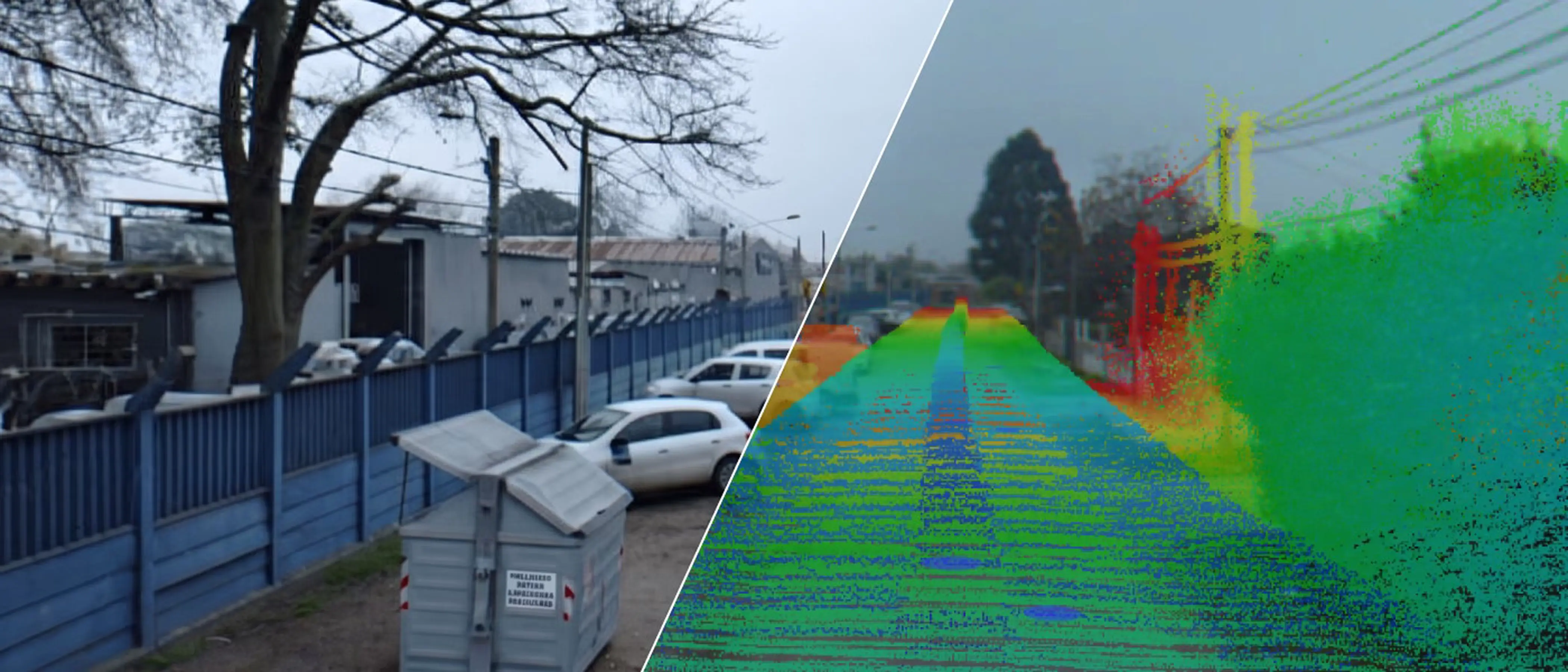
CIEMSA is one of Uruguay’s leading engineering, construction, and maintenance companies, delivering large-scale public and private infrastructure projects across energy, telecommunications, and urban services since 1962. Part of that work involves surveying public spaces, cataloguing signs, traffic lights, trees, and other street elements, a task traditionally done by crews walking street by street. The process was slow, labor-intensive, and prone to human error. CIEMSA set out to replace it with a mobile system: a van equipped with multiple LiDAR sensors, a 360-degree camera, and high-precision GNSS that could capture geo-located 3D data of roads and their surroundings while driving at traffic speed.
CIEMSA needed to automate the surveying of public spaces, capturing geo-located 3D data from a moving vehicle instead of on foot.
What We Built
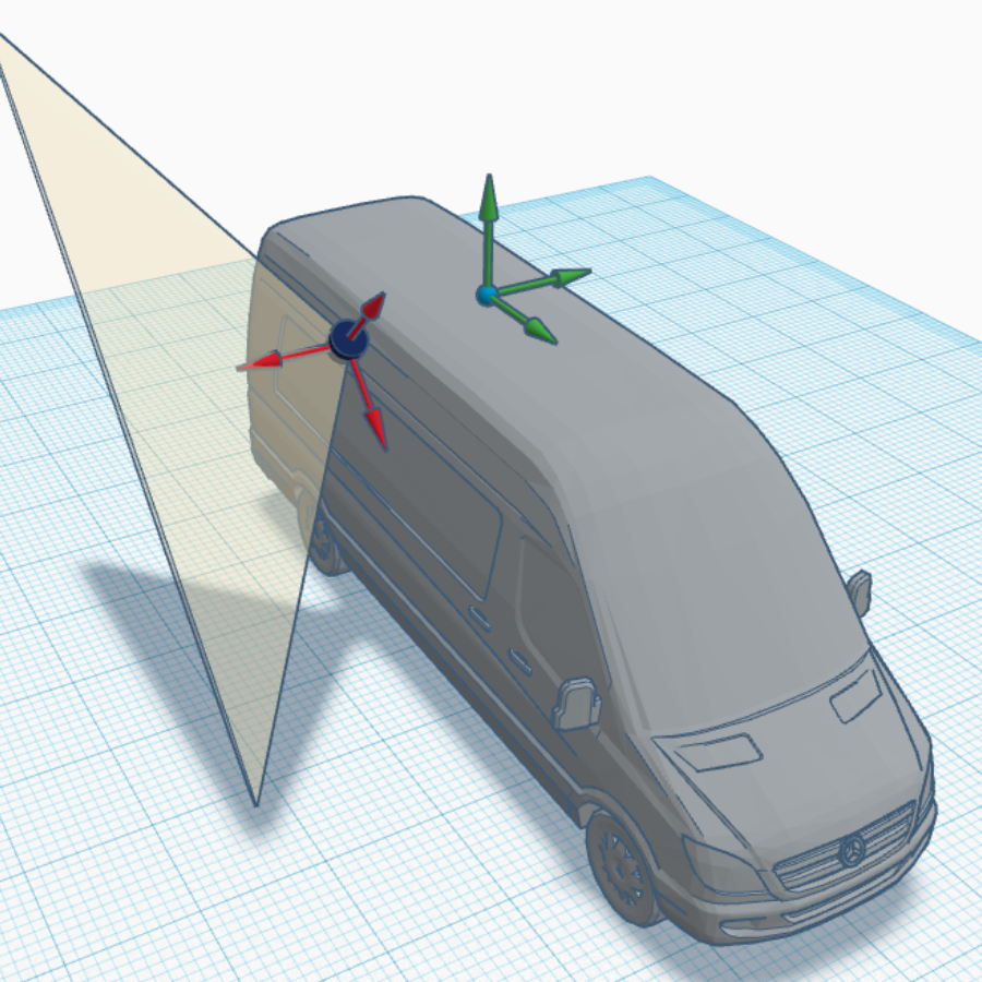
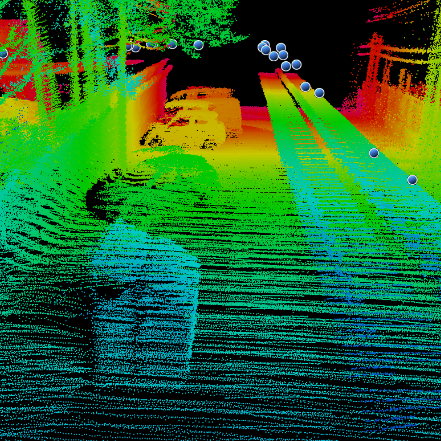
Focus developed the onboard software running on an industrial server inside the vehicle, responsible for acquiring, synchronizing, and processing data from the full sensor suite: two SICK LMS 511 PRO LiDARs, a Velodyne VLP-16 LiDAR, a FLIR Ladybug 5+ 360-degree camera, and an Applanix POS LV GNSS + IMU unit for geo-referencing. Built on ROS (Robot Operating System), the architecture uses dedicated nodes for sensor communication, coordinate transformation, and data fusion, making it scalable as sensors are added or replaced. Custom nodes read each sensor stream, apply reference system changes, geo-reference every measurement, and compile the output into point cloud and image formats ready for Orbit GT 3D mapping software. The work also covered sensor calibration and a simple graphical interface for operators to control acquisition from inside the vehicle. Focus worked iteratively with CIEMSA throughout, refining the system against agreed milestones.

Impact
The system turned a manual, street-by-street process into automated data collection from a moving vehicle, changing how CIEMSA surveys public infrastructure.
Drastically Faster Surveys
Capturing data while driving replaced crews surveying on foot, reducing the time needed to map streets and their surroundings from what used to take days of fieldwork.
Higher Accuracy, Fewer Errors
Geo-referenced LiDAR and 360° imagery enable automated detection of signs, traffic lights, trees, and other street elements, reducing the human error inherent in manual surveys.
Seamless Integration with 3D Visualization
Point clouds and images are delivered in formats compatible with Orbit GT, so field data flows directly into CIEMSA’s mapping and analysis workflow without manual conversion.
By fusing LiDAR, 360° imaging, and precision GNSS into a single embedded system, Focus helped CIEMSA bring automation and accuracy to the way cities map their public infrastructure.
Start building together!
Let’s Innovate Together!



© Copyright 2026 Focus. All Rights Reserved.